


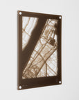
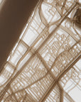
Acrylic Wall Map, Luxor - Designer Series
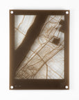
Model shown in Frosted Light Bronze.
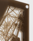
The Atlas Obscured Collection Acrylic Wall Map consists of four layers of laser-cut maps precisely layered to showcase the evolution of a city over time.
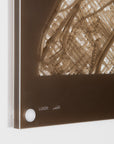
Material: Acrylic
Dimensions: 22½in H x 17in W x ⅝in D
Map Scale: 1in = 500ft
Lead Time: Up to 1 Month
Designer Series Wall Maps are made to order utilizing thoughtfully curated maps and narratives. Each piece is made with intention and care. As such, production timelines may be subject to minor adjustments in rare cases. Please allow additional time for shipping.
Made From Four Layers of Historical Maps


OCCUPYING OVER 3,500 YEARS OF LUXOR HISTORY
Top Layer
2026
Modern Luxor has grown around the remains of ancient Thebes, with archaeology and tourism playing a central role in the city’s identity and economy.
Luxor Temple and Karnak remain prominent landmarks, while the West Bank preserves the Valley of the Kings, tombs, and monumental temples built during Egypt’s New Kingdom.
Ancient monuments, modern neighborhoods, agriculture, and the Nile now exist together within a landscape that preserves thousands of years of continuous history.


Second Layer
1800
The grandeur of ancient Thebes has long since disappeared as a functioning city, and settlement has contracted around the surviving ruins and the Nile.
Luxor is a small Egyptian community within the Ottoman Empire, whose economy and daily life are tied primarily to agriculture, the river, and local trade, while the ancient temples stand partially buried and incorporated into the living settlement.
The French invasion of 1798–1801 briefly disrupts Ottoman control and brings European scholars and artists to Egypt, intensifying European interest in the monuments of ancient Thebes.
Third Layer
300 CE
By the late third century CE, ancient Thebes is no longer Egypt’s political center, but its temples remain important religious and cultural monuments under Roman rule.
At Luxor Temple, the Romans construct a fortified military complex around the ancient sanctuary, adapting parts of the temple itself for military and imperial purposes; reliefs are plastered over and repainted with images of the emperor Diocletian and his co-rulers.


Bottom Layer
1550 BCE
Around 1550 BCE, Thebes emerges as the capital of a reunified Egypt and enters the New Kingdom, beginning a period of extraordinary political power, wealth, religious importance, and monumental construction.
The city centers on the worship of Amun-Ra, with Karnak serving as the great religious complex and Luxor Temple forming part of a sacred landscape connected by a processional avenue.
As Egypt expands its influence into Nubia and the Near East, tribute and trade brings immense wealth to Thebes, funding temples, royal monuments, tombs, and an increasingly sophisticated urban landscape along the Nile.

MAP LOCATION
1. Luxor Temple
2. Ancient Luxor Quay
3. Luxor Museum
4. Avenue of Sphinxes
5. Nile River
6. Karnak
